Interactive widgets for topographic data analysis and modelling in Jupyter notebooks.

Project description
[](https://mybinder.org/v2/gh/fastscape-lem/fastscape-demo/master?urlpath=lab/tree/ipyfastscape) [](https://github.com/fastscape-lem/ipyfastscape/actions)
# ipyfastscape
Interactive widgets for topographic data analysis and modelling in Jupyter notebooks.
While ipyfastscape is tightly integrated with [fastscape](https://github.com/fastscape-lem/fastscape), it also integrates very well with any data in the form of an [xarray](https://github.com/pydata/xarray) dataset or any model created with [xarray-simlab](https://github.com/benbovy/xarray-simlab).
## Features
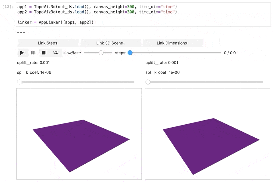
TopoViz3d: 3D terrain visualization

AppLinker: Easily link different application instances for, e.g., side-by-side comparison
<img src=”https://user-images.githubusercontent.com/4160723/95762839-8af3ac00-0cae-11eb-8080-0472e7e6b9d6.gif” width=”640” title=”AppLinker demo”>
Release history Release notifications | RSS feed


Download files
Download the file for your platform. If you're not sure which to choose, learn more about installing packages.
Source Distribution
Built Distribution
Hashes for ipyfastscape-0.1.0-py3-none-any.whl
| Algorithm | Hash digest | |
|---|---|---|
| SHA256 | 30bc869593c460a01c7391e09a329fe834eaba167a4f30b40630fed79936785a |
|
| MD5 | d8e6b72e56a8dacdeebaf4542b4fcd8f |
|
| BLAKE2b-256 | 5f260c9e455d530e999c145cc50c896587c2d5c11a8dc20a1f0a1a20a27b928c |


](https://mybinder.org/v2/gh/fastscape-lem/fastscape-demo/master?urlpath=lab/tree/ipyfastscape)
](https://github.com/fastscape-lem/ipyfastscape/actions)